Category : Local History

Originally posted at http://www.danielboonetrail.com/historicalsites.php?id=46.

The Revolutionary War was fought on two fronts; from its beginning in 1775, until the treaty of peace in 1783, it was fought on the western front against the Indians, chiefly by the pioneers of Kentucky and frontiersmen of Virginia, Pennsylvania, and the Carolinas. It was fought in a more conspicuous theatre along the Atlantic seaboard by the colonists against the British regulars.

Curiously enough, almost exactly at the time of the firing of the first gun of the Revolution at Lexington, Massachusetts, the Wilderness Road was connected up into a bridle path, which joined the western Virginia border with Central Kentucky. ?This alone made Kentucky’s settlement possible, at that time, and that settlement, in turn, furnished the necessary base for the conquest of the Northwest by the frontiersmen under George Rogers Clark. The road is significant, therefore, not only in the history of Kentucky, but in that of the Revolutionary War.

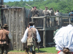
Martin’s Station was the feature of man’s providing on the road that was most important in making it a practical way into Kentucky. It was a long, hard road. The road through the wilderness began at the blockhouse, which faced Moccasin Gap, where the Indian country began. It ran its winding course through valleys and along creeks, across the Holston, Clinch, Powell, and Cumberland rivers; over Powell Mountain and Wallen’s Ridge (as difficult as Powell Mountain), down Powell Valley, over Cumberland Gap, through the gorge where the Cumberland River cuts its way through Pine Mountain, and then through the foothills until it reached the plateau of Central Kentucky at Crab Orchard and Berea.
Its course had been followed, in a general way, by a few hunters and land lookers in the ten years before 1775, but it was definitely marked to Boonesborough by Boone, when he led the party for Col. Henderson and the Transylvania Company from Long Island to Boonesborough in March and April 1775.

Its whole course, from the time it passed Moccasin Gap, was in a country which the Indians infested. They resisted the invasion by the whites, not only to protect their hunting ground, but at the instigation of the British, who recognized the danger to their hold on the West by the thrust of the Kentuckians into the heart of it.

For the 200 miles of the course of the road through the wilderness, there was neither Indian nor white settlement. There was no base of supplies and no refuge, save only at one spot, and that was Martin’s Station in Powell Valley. That was what made Martin’s services in the establishing of his station along the Wilderness Road so important.

Martin’s Station was located 20 miles eastward of Cumberland Gap. It was the halfway house between Virginia and Kentucky; the lone station midway of the journey through an uninhabited district. Every traveller over the road had the support of Martin’s Station on his mind, and those who made written records of their journeys mention it in a way to indicate the importance attached to it.

The station was located exactly on the Wilderness Road where it crossed a creek, later called Martin’s Creek, in Lee County, Virginia. The present state road between Boone’s Path on the east, a third of a mile away; and Rosehill on the west, half a mile away, passes through the old station grounds.

The cabin stood on a low mound about 70 yards to the east of Martin’s Creek, a stream big enough, as Martin said, “to turn a mill;” and 30 yards from a bold, overflowing spring, both of which were doubtless included within the stockade of the station.

Martin was born near Charlottesville, in Albermarle County, Virginia, in 1740, of an affluent family. From boyhood, he took to Indian adventure, and it is probable that he entered Powell Valley as early as 1761.

In 1769 he was allotted, by Dr. Thomas Walker, 21,000 acres for the first settlement in the valley, and in the endeavor to hold this land, he undertook to found a station there in the spring of 1769. The station was attacked by Indians. As a result, it was abandoned in the fall of the same year.

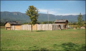
In January 1775 Martin went back with a party of 16 or 18 men and built a station, which included four or five cabins for the men and a stockade on exactly the old site. Thereafter, the station remained, although, at times, unoccupied throughout the period of the early emigration to Kentucky.

The reestablishment of the station in January 1775 was, perhaps, in anticipation of the organization of the Transylvania Company, which was consummated in March of that year. Whether that is so or not, when Boone (and a little later, Henderson) went to Kentucky with their parties in the spring of 1775, Martin was at his station; and furnished a base for the final journey into Kentucky.

He effectively cooperated with Henderson throughout the existence of the Transylvania Company. Henderson, indeed, seems to have used Martin, the executive and diplomat with the Indians, as his business agent at this outpost; as he did Boone, the hunter and explorer, for leading his expedition into Kentucky.

In 1777 Martin reestablished himself at his old station, where he conducted Indian affairs for a wide district, until he retired as Indian agent in 1789.

Martin’s Station is well-known to students of the Wilderness Road, but Joseph Martin had no Filson to celebrate his feats, as Boone had, and he has been almost forgotten. Professor Stephen B. Weeks, of Johns Hopkins, resurrected him in an accurate biographical sketch, which he read before the first meeting of the American Historical Society. But this, in turn, was buried in a government report.

Martin’s work in connection with Martin’s Station and the emigration to Kentucky constitutes only a small part of the accomplishments, which entitle him to be remembered. He was not only one of the most important men in Indian affairs, but in all public affairs in western Virginia and North Carolina. Until 1789 he was chiefly engaged with Indian business. After that time he was a leader in public affairs, in general, on the southwestern frontier.

In 1777 Gov. Patrick Henry commissioned him agent and superintendent of Indian affairs for the state of Virginia, a position he retained until 1789. Because of his influence in restraining the Cherokees, he, more than anyone else, kept the Indians off the backs of the settlers on the Virginia and Carolina frontiers and left them free to cooperate with the other colonial troops against the British in the South. That made victory at King’s Mountain possible, and that, in turn, assured a few months later, the hemming in and capture of Cornwallis at Yorktown.

Until he was nearly 60, Martin was engaged in all sorts of public affairs in a way that marked him as a leader: Indian agent (not only for Virginia, but also for North Carolina), on peace commissions, on boundary commissions (notable that on the western boundary between North Carolina and Virginia, and that between Virginia and Kentucky); brigadier general on appointment of Gov. Henry Lee, of Virginia, and for many years in the Virginia Legislature.

He gave up participation in public affairs in 1779, in his 60th year, and retired to his estate in Henry County, Virginia, where he died on December 8, 1808, in his 69th year.
Originally posted at http://www.danielboonetrail.com/historicalsites.php?id=85.

Written by Sally Kelly

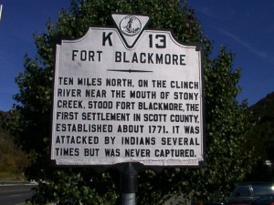
The site of Fort Blackmore can be reached from Gate City, Virginia. At the Daniel Boone Wilderness Trail sign in front of the Scott County Courthouse, proceed East (right) on Jackson Street/Rt. 71. After approximately two miles, turn left onto Rt. 72, following signs for the present day community of Fort Blackmore. After about ten miles, you will cross over the Clinch River on a large bridge. Historical Fort Blackmore was on the north bank (far bank), to the left of the bridge. The site is on private property. At the north end of the bridge, on your left, is a monument erected by the DAR which tells about Daniel Boone and his connection with Fort Blackmore. To return to the Daniel Boone Wilderness Trail, turn around and retrace the route.

John Blackmore settled on land at the mouth of Stoney Creek on the Clinch River in 1773. He purchased 518 acres from the Loyal Land Company, and his acreage was surveyed on March 25, 1774 by Captain Daniel Smith, deputy surveyor for Fincastle County. At about the same time, surveys were entered for Isaac Crisman, John Thomas, Dale Carter, and John Blackmore, Jr. John Blackmore came to this area from Fauquier County, Virginia. At this time, Daniel Boone and his family had been living on land owned by David Gass, near Castle’s Woods, some dozen or more miles east; ever since Boone’s son James was killed by Indians as a party of settlers made its attempt to go to Kentucky in October, 1773. Young Boone, on that occasion, was traveling separate from the main party, in company with Henry Russell and others. Russell, son of Captain William Russell, “a Gentleman of Some distinction.” according to Royal Governor Lord Dunmore, was the organizer of that attempt, and Boone was the logician. After the murder, the immigration effort was aborted and some of the settlers returned to the Yadkin, and a few stayed on in the Clinch and Holston settlements.

In the aftermath of the murder of the boys, one of the survivors, one Isaac Crabtree killed an innocent Cherokee at a horse race near what is now Jonesborough, Tennessee. This event, and another brutal slaying by white frontiersmen of the nine members of the Mingo tribe on the Ohio in April of 1774 had stirred the tribes along the frontier into a war-like mood. Those few men taking up land on the Clinch were brave souls for many “families on the river had moved back to safety” according to surveyor Smith. Much of the detail that is known of Fort Blackmore comes from the correspondence of officers of the militia during the following months, in what became known as “Lord Dunmore’s War.”

The commanding officer of the Fincastle County Militia was Colonel William Preston, who resided near what is now Blacksburg, Virginia, on the New River. Officers reporting to him included Captain Russell on the Clinch; Major Arthur Campbell, Fort Shelby – at what is now Bristol; and Captain Daniel Smith, mentioned above. In a letter dated May 24, 1774, Colonel Andrew Lewis, of Augusta County, advised Preston that “Hostilities are actually commenced on the Ohio below Pittsburg.” In a War Council in June at the Lead Mines, near Fort Chiswell on the New River, it was decided to send militia under Colonel William Christian, Augusta County, to aid William Russell; and “at Preston’s instigation, William Russell sent Daniel Boone and Michael Stoner to tell John Floyd and other surveyors to come in from Kentucky. These two left for Kentucky on June 27, 1774.” This mission would first bring the previously obscure Boone’s name to widespread public attention.

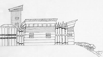
It was a tense time among the scattered settlers along the Clinch River. On July 12, Colonel Christian wrote Preston that “four forts [are] erecting in Capt. Russell’s Company; one at Moore’s, four miles below this, another at Blackmore’s 16 Miles above this Place [Castle’s Wood] I am about to station 10 Men at Blackmore’s.” On the 13th, Captain Russell notified Preston “there are four families at John Blackmore’s near the mouth of Stoney Creek, that will never be able to stand it, without a Commd. Of Men, therefore request you, if you think it can be done, to Order them a supply sufficient to enable them to continue the small fortification they have erected.” Thus the fort took the name of the man on whose land it was built.

Captain James Thompson was the first officer put in command of the little fort. Men in the community were quite eager to join Lord Dunmore’s expedition to stop the Indians on the Ohio before they could come into the frontier settlements. Col. Preston had stated, “the plunder of the Country will be valluable. . . . it is said the Shawnese have a great Stock of Horses.” Those in command along the Clinch and Holston had difficulty manning the local forts with many eligible men wishing to go. On August 27, Daniel Boone returned from his mission to Kentucky; and almost immediately begged of Major Campbell to be sent on to Point Pleasant on the Ohio. Lord Dunmore had agreed to meet the forces from back country counties there with men he brought along from Tidewater. Boone set out, but was called back by Captain Russell to help defend the little Clinch River community as officer in command at Moore’s Fort.


On September 21, Captain Thompson went out with those Ohio-bound forces, and Captain David Looney was put in command at Blackmore’s Fort. On September 23 or 24, it was reported that “2 negroes [were] taken prisoner at Blackmore’s Fort, on waters of Clinch River, and a great many horses and cattle were shot down.” Captain Looney was absent, visiting his family on the Holston. Major Campbell wrote Col. Preston on the 29th that “Mr Boon is very diligent at Castle Woods and keeps up good Order. I have reason to believe they have lately been remiss at Blackmores, and the Spys there did not do their duty.” Two days later he wrote “Mr. Boone also informs me that the Indians has been frequently about Blackmores, since the Negroes was taken; And Capt. Looney has so few Men that he cannot venture to go in pursuit of them, having only eleven men.” On the sixth of October Campbell wrote to say that Indians had attacked at Shelby’s Fort without success; and the day after that, he said, was the attack at Fort Blackmore. An alarm of their presence was given by Dale Carter, crying “Murder, Murder!” Ensign John Anderson and John Carter ran out of the fort to help, but Dale Carter was killed and scalped; and the slaves were taken. After this, the people of the area were feeling that they needed a commander who lived on the Clinch. October 13, Captain Smith wrote Col. Preston that he had been shown a paper signed by inhabitants requesting the appointment of Daniel Boone to be Captain and take charge of the Clinch forts. Smith endorsed this request and stated “I do not know of any Objection that could be made to his character which would make you think him an improper person for that office.” Preston immediately promoted him.

Boone treasured his commission and carried it with him always until he was promoted again during the Revolution. Meanwhile, information was beginning to be received in these frontier parts that a battle had been fought at Point Pleasant on the Ohio between the forces of Colonel Andrews and the Indian tribes on October 10. Those forces met up with the Indians before they could join up with Lord Dunmore’s men, and fought a very successful engagement. Shortly thereafter, Dunmore negotiated a peace agreement ending the hostilities at Camp Charlotte. Some portion of the Shawnee nation agreed to give up it hunting rights in Kentucky if settlers would remain below the Ohio River. Local militias were disbanded, and November 21, Daniel Boone was dismissed from his duties. The Cherokee now were the only force with which to be reckoned for the settlement of Kentucky.

Again, Daniel Boone would support a prominent man in a Kentucky settlement venture. Judge Richard Henderson of North Carolina, in late 1774, negotiated with Cherokee chiefs to purchase a large plot on land in Kentucky, irregardless that he could not do so legally; and that the Cherokee had no real claim to the land they sold to him either. He engaged Boone to go among the Cherokee during late 1774 to encourage them to meet at Sycamore Shoals on the Watauga in March, 1775, for the formal agreement and transfer of the goods that would pay for the purchase. Boone returned to the Clinch in early February and gathered some twenty men there to help him blaze the path through Cumberland Gap to the land Henderson wanted. Not all are known, they included Michael Stoner, David Gass, William Bush, and William Hays. It is not unlikely that this group included some of the men from the Fort Blackmore area. Squire Boone brought others from North Carolina and the combined band of trail blazers set out from John Anderson’s Blockhouse, on the North Fork of Holston, on March 10. Boone left the new Kentucky settlement, named Boonesborough in his honor, on June 13, 1775, enroute once more for the Clinch. “Boone set off for his family.” Henderson wrote in his journal. When Daniel arrived there, he found Rebecca about to give birth. In late July, she gave birth to a son, William, who did not survive.

In mid August, Boone and family, and a party of some 50 immigrants set off for Kentucky. Probably some of them were men from the Fort Blackmore area; and the party would certainly have passed the fort, perhaps stopping overnight, in their westward journey. This ends Boone’s association with Fort Blackmore. But the fort continued as a place of refuge for many more years. 1775 was a relatively peaceful year east of Cumberland Gap, but hostilities with the Cherokee came again in 1776. Warriors who did not agree with the chiefs who treated with Richard Henderson, led by one Dragging Canoe, began attacks along the frontier. And there were many Indian attacks in Kentucky that caused large numbers of immigrants to flee back over the Cumberlands to the Clinch, Holston, and Watauga settlements. One such Kentuckian, William Hickman, arrived at Fort Blackmore on the Clinch, where he found other refugees “sporting, dancing, and drinking whiskey in an attempt to forget their fears.” “Things could get pretty rancid.” he said, “after a long period of confinement in a row or two of smoky cabins, among dirty women and men with greased hunting shirts.” In June, two men were killed at the fort. And in September one Jennings and his slave met death at the hands of Indians.

Other forts had been erected along the Powell River, west towards Cumberland Gap, during 1775, including Priests, Mumps, and Martin’s. Col. Joseph Martin’s station was erected in January of that year, and he noted in his journal the stopover of the Henderson party of Kentucky settlers about the first of April. Col. Martin left in May to visit at his home in Virginia. Soon the people from Mump’s and Priest’s were driven out. When there were no more than ten left alive at Martin’s, those men fled to Fort Blackmore, where they found most of the people from the Mump’s and Priest’s forts. In July, 1776, Cherokees in force attacked at the fort at Sycamore Shoals on the Watuaga, and battled local militia at the Battle of Long Island Flats, near present Kingsport, Tennessee. About the same time, one Ambrose Fletcher, living near Fort Blackmore, had his wife and children killed and scalped. Colonel William Christian was again called upon by Col. Preston, this time to put down the Cherokee uprising. Jonathan Jennings of Fort Blackmore, and father of the Jennings who was killed, mentioned above, accompanied that expedition to the Cherokee towns on the Middle Tennessee River. After that, mention of Fort Blackmore in the known historical record becomes scanty.

There is one famous story, dating from 1777, that may or may not be true. Men in the fort heard a turkey gobbling. They wanted to go out hunting, but were prevented by a knowledgeable backwoodsman, one Matthew Gray. He convinced them that they were hearing Indians. He directed the men to create a distraction on the bank of the river, while he snuck across the Clinch. He was able to get where he could see the Indian warrior perched in a tree, making the turkey noises. Mr. Gray dispatched the “turkey” and fled back into the fort with the others. In 1779, John Blackmore and his family left the area to travel with the Donelson party, traveling by flatboat, to settle in middle Tennessee. Donelson mentions meeting up with the Blackmore group at the mouth of Clinch where it joins the Holston, so John Blackmore’s band must have gone down the Clinch by flatboat. Perhaps not all Blackmores left the Clinch – or possibly some came back – for they are mentioned again in April, 1790 in the journal of Methodist Bishop John Asbury. “We rode down to Blackmore’s Station, here the people have been forted on the north side of Clinch. Poor Blackmore had had a son and daughter killed by the Indians. They are of the opinion here that the Cherokees were the authors of this mischief.” Asbury goes on to say he had heard of two families being killed and of one woman being taken prisoner, but retaken by neighbors A few days later, the Bishop traveled on, noting that he “Crossed the Clinch about two miles below the fort. In passing along I saw the precipice from which Blackmore’s unhappy son leaped into the river after receiving the stroke of the tomahawk in his head . . . this happened on the 6th of April 1789.” Indian attacks on settlers along the Clinch, Holston, and Watuaga Rivers did not cease until after 1794, when a half breed, Benge, who had led many of the forays, was killed near what is now Big Stone Gap. Benge committed his last crimes near what is now Mendota, Virginia, on the North Fork of the Holston. He fled, with two captive women, over the Clinch Mountain, Copper Ridge, and, finally, High Knob Mountain before being caught up with.

This route probably took him very near Fort Blackmore. And so, it was right in the middle of Indian unrest from its beginning to its end. Just exactly when it was abandoned as a fort is not known. The land owner believes he is able to point out where the fort stood; but, for the most part, it has disappeared from sight. Its little cemetery is still findable, below the current highway bridge over the river, and to its right, near the bank of the river. Scott Countians who care for old cemeteries keep it cleaned and accessible. Many of its graves are unmarked.

Blackwater, Virginia

by W. Dale Carter, copyright 2002, Kingsport, TN

The small community of Blackwater has been mostly unnoticed by historians of southwest Virginia. It was given its name of Blackwater by the first hunters that ventured into the area perhaps as early as the 1750s.
At that period of time, a spring or stream that contained minerals such as common table salt was referred to as Blackwater [Etymology: “The history of linguistic form”] The term brackish water derives from the Low Saxon word brackwater, which is the water of a brack. A brack is a small lake created when a storm tide breaks a dike and floods land behind the dike.  Low Saxon (in Low Saxon, Plattdüütsch, Nedderdüütsch or Neddersassisch) is any of a variety of Low German dialects spoken in northern Germany and the Netherlands. It also includes Plautdietsch, which is spoken by Mennonites in North America.
Blackwater is located at the crossroads of the old trading route from the Cumberland River to the Cherokee nation in East Tennessee and the old hunters trace from the New River to Kentucky. Today, Blackwater is an isolated community as to commerce and transportation, but it was not so isolated in the mid eighteenth century due to the large Buffalo lick. Over the eons of time, herds of buffalo had carved out trails radiating out from the lick to the grazing meadows in Powell Valley, Rye Cove, and south to the Clinch River valley. Herd animals would travel great distances to a salt lick to replenish their need for salt, an essential mineral in their diet. A salt lick is a site where the soil and rocks contain a natural deposit of salt and was called a lick because the animals would lick the soil or rocks to a depth of several feet to satisfy their need for this essential element.

A salt lick was the favorite hunting site of the Indians and long hunters. The hunters would position themselves at strategic points along the trails the animals traveled to the lick and make their kill. Numerous historical records of the frontier give accounts of the well known licks such as the Bledsoe lick in Sumner County Tennessee, the Blue lick in central Kentucky and the French lick in southern Indiana, but little is known about the large lick at Blackwater. Perhaps this is because the Blackwater lick was discovered at least a quarter of a century before the licks in Sumner County in Tennessee, Kentucky, and Indiana and by the time of their discovery the pressure of hunting at the Blackwater lick had depleted the size of the herd animals to near extinction; however, the trails carved out by buffalo remained and were used by the hunters as the choice route leading from the frontier to Kentucky. The long hunters knew about the lick as early as 1761, and it was a landmark on the old hunters path from the New River to Powell Valley.

Land records tell us much about the route the hunters took to seek game around the large salt lick and the grazing grounds in Lee County. The Hunters path is well defined until it reaches the little salt lick, Duffield, but from this point little is known about the route to Powell Valley; however, the land surveyors made notations on their surveys that give clues as to the route of the path. A land grant to Arthur Campbell [LO 45-325] describes the location of the grant as being at the Hunters Gap in Lee County and on both sides of the Hunters path. This tells us that the Hunters path ran along the south side of Powell Mountain from Duffield to Blackwater and crossed the mountain at Hunters Gap. The path ran down Wallen creek to near it mouth on Powell river where again the land surveys pick up the route of the Hunters path.

Another grant to Arthur Campbell [LO Q-318] is described as being on the south side of the Powell River and on both sides of the Hunters path. This grant is located about one mile west southwest of where Wallen Creek flows into Powell river. The Campbell grant [LO Q-318] is adjoined on the west side by a land grant to Robert Preston [LO 27-57]. The Preston grant is described as lying on both sides of the Hunters path. From this information, we know that the Hunters path ran from near the mouth of Wallen Creek across the area known as the Rob bottoms and crossed the Powell River at White shoals. Again, the surveys tell us that the path ran in a north or northwest direction from White shoals as a grant to Robert Preston [LO 27-41]is described as lying on the west side of trading creek and one of the survey points is described as “white oak south side of the old Kentucky trace on John Ewing line with same”. From this point, the path or trace ran to Martins station but the exact route cannot be proven by land records.

Records show that Elisha Wallin and William Newman hunted around the Blackwater buffalo lick as early as 1761. Wallins Ridge and Newman Ridge were named after them. Other long hunters surely knew about the lick. Evidence of the buffalo trails remains on modern maps by the names of geographic features such as hunters ford, hunters valley, hunters gap and hunters branch. No doubt the long hunters in quest of game followed the herd animal paths from their favorite grazing grounds to the salt licks. There were many small licks in the area used by deer and other small game, but needs of the herd animals would require the mineral deposits of a much larger lick such as the Buffalo Lick at Blackwater.

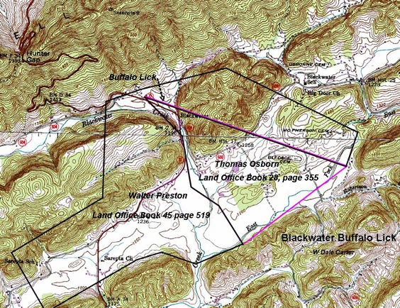
The importance of the Blackwater lick is clearly pointed out by the claims of the land speculators. As early as 1775, Thomas Osburn had settled on land adjoining the Buffalo lick and obtained a land grant from the Commonwealth of Virginia by virtue of Right of Settlement.  “Washington County Survey Book 1,Page 389 Commissioners Certificate – on the forks of black water a north branch of Clynch River – beginning at the foot of Powells Mountain on the west side of the Buffalow Lick – at the foot of Newman’s ridge on both sides black water joining Powells Mountain, includes improvements, actual settlement made in 1775 – August 22, 1781”.

The name Blackwater appears in land claims as early as 1775, and the name was known far and wide. Claims were filed in the Virginia Land Office and the North Carolina Land Office for land at Blackwater so hunters from North Carolina and Virginia had spread the word about the large buffalo lick at the Blackwater.  From the North Carolina Archives, we find that Walter and Robert King filed an entry with the North Carolina Land Office for 250 acres that was to include an old buffalo lick.  “Recorded in North Carolina Land Office File No 28 Hawkins County records. Walter King & Robert King make entry No 1947 entered 12 Oct 1779,250 acres near the foot of Powell mountain by the name of Black Water: Beginning near the creek at a poplar, white oak, poplar s;150 poles to a stake, then W;280 poles to a stake, then n;150 poles to a stake, to include an old Buffalo Lick, surveyed 16 Sep 1793. Thomas Church assigned his interest in the Wilkins land to William Hord and Hord assigned it to Walter King & Robert King 1 Nov 1792”.

In the meantime, Walter Preston was issued a land grant from Virginia that bordered the Thomas Osborne grant and included the buffalo lick. To further complicate the issue Arthur Campbell also obtained a grant from Virginia that included the buffalo lick, all of the Thomas Osborne grant and much of the Preston grant. Apparently Preston ended up as the legitimate owner as he sold his grant to James White. The heirs of Campbell made an effort to reclaim their Blackwater grant, but I find no record that they were successful.  The Thomas Osborn grant ended up under the ownership of James and Stephen Osborn. A deed recorded in Lee County Deed Book 3, page 189: “Stephen Osborn & Comfort & James Osborn & Mary to William Roberts, 31 Jul 1810, DB 3-189. 400A by survey only the 1/2 of the Buffalo lick excepted for James Osborn the same being the west side of the said lick running through the middle thereof with the conditional line made by John Osborn & Roberts from thence marked around the lick on or near the bank of the same $650”.

This deed shows that James Osborn reserved for himself ½ interest in the salt lick when the Thomas Osborn grant was sold to William Roberts. Apparently the lick site was developed as a salt works as a deed made 29 December 1817 and recorded in Lee County Deed Book 3, page 399, shows that William Roberts and his wife, Catherine sold ¼ part of a tract known as the Blackwater tract, to Jessee G. Rainey.  “Being a part of tract said Roberts purchased of James & Stephen Osburn. Including the lick premises and well, now occupied by said parties together and including 100 acres”.  The deed shows that by the year 1817 a well had been dug at the salt lick site. On 5 June 1818 William Roberts and wife sold 1/8 part including the lick premises and well recorded in Lee County Deed Book 3, page 405, and on 12 May 1818 William Roberts and wife sold ½ interest of the lick tract to Joseph and James McReynolds of Bledsoe County, Tennessee for $3,000. Recorded in Lee County Deed Book 3, page 406. The McReynolds deed shows that something of great potential lay within the boundary of the tract. At that point in time, land in and around Blackwater was selling for $1 to $2.50 per acre. The McReynolds paid $60 per acre.

From this time forward, the land records do not show what happened as to the ownership of the salt lick tract; however, on 19 January 1835, by order of the Lee County court, Jacob V Fulkerson, commissioner of the court, sold one moity of the Blackwater salt lick to Dale Carter of Russell County, Virginia. Carter was a large land owner and land speculator who owned large tracts in the Elk Garden and in present-day Wise County, Virginia.

Why all the interest in the buffalo lick? Most likely these early land speculators had visions of developing the site as a salt works much like the one at Saltville. In fact, a salt works was operated at Blackwater for a period of time.

In conclusion, the first white traders with the Indians and the long hunters used the buffalo lick at Blackwater as a well known land mark to describe the route from the frontier to the hunting grounds in Powell Valley and Kentucky. The buffalo paths from the grazing grounds led to the lick.  Daniel Boone in his aborted journey to Kentucky in 1773 most likely used the hunters path to the Powell river. It was a route well known to him and other hunters. The Boone party consisted of some forty individuals, pack horses and a small herd of cattle. A party this large would have had to follow a well-defined Buffalo trail to keep some order to their journey.

Lee County Order Book 2, page 364 27 Jan 1818; David Burk proposes an alteration in the road leading from the Blackwater salt works up Blackwater to the state line.

Lee County Order Book 2, page 374, 29 Apr 1818: John B Neil, Elisha Rogers; Thomas Roberts; William Wallin and David Lawson view a road from the forks below the Blackwater salt works to John B Neils.

Elisha Wallen the Long Hunter

From: Pathfinders, Pioneers, & Patriots

originally posted at http://www.ancientfaces.com/research/story/383170

Born in 1732 in Prince George County, Maryland, Elisha Wallen was to become an important character in the history of the settlement of the West.

He stood about 5’10” tall and weighed about 180 lbs., was squarely built, and had a dark complexion with rough features. Although he had little education, he was quick witted, easy-going, and very honest and disciplined.  He lived entirely by hunting, and the knowledge he acquired on his expeditions did much to encourage settlers to follow.

In 1761, as soon as the Cherokee were pacified, Wallen gathered a group of relatives and friends for a big hunt far beyond the settlements in the valleys of the New River. With him were his father-in-law, brother-in-law, William and Jack Blevins, Henry Skaggs, Walter Newman, Charles Cox, and about a dozen other trained woodsmen (including Daniel Boone, who traveled with the party to Wolfe Hills, (Abingdon, Va.) ). They crossed the Blue Ridge Mtns., into the road leading beyond the New River and ranged into the hidden coves and valleys of the Holston, Clinch, and Powell Rivers. They followed buffalo paths to big licks, wandered up and down streams, and crossed rugged mountains. And they found a veritable hunter’s paradise. They feasted on the game and collected many skins and furs for the Eastern Market. In camp they built pole scaffolds several feet above the ground on which they piled their pelts. A pole on top kept the skins packed together. An elk or buffalo hide, or strips of bark protected them from the weather. When enough were collected, the men folded and packed the pelts in bales weighing 50 – 100 pounds. Two bales made a horseload.

Their trip lasted for 18 months and covered much of the wild region between Long Island and Cumberland Gap – the country later traversed by the Wilderness Road. They named many ridges and streams. Wallen himself is remembered by Wallen’s Ridge and at least two Wallins’ Creeks.

Newman’s Ridge was named for Walter Newman, a member of the party. Wallen’s men changed Walker’s Beargrass River to Powell River, because of the frequency with which they came upon “A.Powell” – carved by Thomas Walker’s companion on beech trees along the bank. It is also likely that they changed the name of “Cave Gap”, to “Cumberland Gap”.to conform with the name by which the mountains were now being called.

In 1762, he participated in a second Long Hunt, travelling through Flower Gap to the New River. From there he proceeded over Iron Mountain at Blue Springs, down the South Fork of the Holston River and on to Elk Garden. Between Jonesville and Rogersville, he made a “station camp” for his hunting party to use as a base for their hunting.

In 1763, he went on his 3rd hunt, with approximately the same group as before. They followed the old trail through Cumberland Gap and trapped on the headwaters of the Cumberland River, in South Eastern Kentucky – notably “Stinking Creek”, a tributary of the Cumberland, often mentioned in the annals of the Wilderness Road. They extended their hunt to Rock Castle Country, and Westward until they encountered flatter land. They came to a large crab orchard at some great springs. That spot, still known as Crab Orchard, became a significant point on the Wilderness Road. News of Wallen’s profitable long hunts, stimulated others on the border. The fur trade was attractive and became an important way for settlers to supplement their income when crops were in.

In 1767, he was elected Captain of the County Militia under Major Theophilas Lay.

Later in his life he built a cabin and resided near his Wallen’s Station between Kyles’ Ford and Jonesville, Va.

Originally posted at http://sites.google.com/site/descendantsofcorneliusroberts/fsdbhdj

13 Aug 2010

Col. James Robert’s Tories were active on the NW side of the Blue Ridge in the Ashe Co., NC area according to Col. Richard Allen’s pension claims. By family associations it has been suggested that Cornelius Roberts (Neal Roberts) is the son or brother of this man, but this is far from proven. James is also likely to be the father of Happy Roberts who married William Riddle and William Roberts who also appeared on the William Herbert 1774 militia accounts. A James Roberts appears in the area northwest of today’s Martinsville, Henry Co., Virginia, by 1753 and in the late 1760s he is joined by a John and Cornelius. James Roberts may be the man who served at the Battle of Point Pleasant under William Campbell.

On 5 July 1776 the land of James Roberts in Montgomery Co., Virginia was confiscated and sold because he had taken up arms with the British. In 1779 his land in Surry Co., NC was also confiscated by act of the legislature in New Bern.

Benjamin Phipps pension app: ” about the year 1779 or 80 he [Phipps] was engaged in making a crop of corn, when Colonel Roberts, at the head of a company of Tories, came there [to Capt. John Cox’s] and made prisoners of him and William Craig and Beverly Watkins. The Tories carred him to the British Army commanded by Lord Rogers…”

David Cox pension app: “Sometime after this affair a certain Captain Roberts of the Tory party came into the neighborhood with a company of –, and this declarant with Major Love pursued them into — near the head of New River, determined to overtake them but Capt. Baker of North Carolina heard of them and his party overtook, wounded or killed the whole party except Roberts their captain who made good his escape…”

George Morris Esq. – an old Whig on New River: “When friends and neighbors collected and pursued them to one Capt. Patrick John – near where the town of Jefferson now stands where they overtook them committing outrages on the old Captain – they had but a bridel rein around his neck and were leading him out of his gate to hang him when the Whigs came up – fixed on them – killed two of the English – wounded the other – took him prisoner – and Capt. Roberts and the other Tory narrowly escaped.”

In the Draper manuscripts, “Roberts was on his route to Ninety-Six with about 20 men though he did not come with him. Col. Roberts was passing through [now] Ashe County and passed by Benj. Cuthbirth’s and robbed his 5 valuable horses. I think this was 1781. Some time after this Capt. James Roberts, son of Col. Roberts passed through Ashe on the same trail that had been traveled by Col. Roberts. The Captain had but 4 men besides himself, one Tory and 3 British soldiers.”

Capt. James Roberts (son of Col. Roberts) is thought to be the same man who later settles on the Clinch, in what is now Lee Co., Virginia and who raises some of William Riddle’s children. In the 1791 tax list for the lower district of Russell Co., VA (became Lee County) are Joseph and William Ingrahm (m. Happy Roberts [or Rogers] Riddle), James Fulkerson (who lived near James Roberts in Pittsylvania [now Henry] Co., VA and sold land to him in Surry Co., NC), Williamson Roberts, John Rice, George Roberts, Philip Roberts, James Roberts (the Capt.), Thomas Rogers, Aaron Roberts, Doswell Rogers, Thomas Rogers Sr., a second Doswell Rogers, William Tate, John Tate, and the Waller/Wallens: Lewis, Elisha, Thomas, John and William.

Source for much of the facts above: Rodney Veitschegger; replies to a question of mine of Roberts Genforum; Mary E.V. Hill (Riddle Newsletter)

Roberts, Neal

Time-line for Cornelius “Neal” Roberts:

Born before 1746 in Halifax Co., VA, possibly a son of the Tory leader, Col. James Roberts (speculative).

1767 Acquired 400 acres in what is now Henry Co., VA. By 1769 he had a survey of 798 acres along a fork of Reedy or Reed Creek called Grassy Fork or Solomons Branch or Glady fork. Listed as Neel Roberts a tithable to Peter Copland Gent. In Pittsylvania (now northern Henry) Co., VA. In 1769 he had another 398 acres or 798 acres total. Another 800 acres were surveyed off Beaver Creek. This land is northwest of Martinsville. John and James Roberts are in the same area and James’ name first appears in 1753. 1771 – on records of Botetourt Co., VA, living on Beaver Dam Fork of Elk Creek in what is now Grayson Co., VA 1772, 1773 – on records of Fincastle Co., VA after it was formed from Botetourt 1774 Served 29 days under Lieut. John Cox, Daniel Boone and Capt. David Looney in Lord Dunmore’s War: They were left behind to guard the frontier he did not make the march to Point Pleasant with Col. Herbert’s men. June 15 1776 “Roberts with Tories on Elk Creek” (Wm Preston to Edmund Pendleton referring to Col. Or Capt. James Roberts I presume.) 1780 Montgomery Co., VA court record: property confiscated for Tory activities ordered returned due to lack of evidence of participation in the Tory militias. He may have been a member of the Elk Creek militia, but I do not find him on the militia musters (there is a John and James Roberts on the Elk Creek militia muster rolls). 1782 owned 150 acres, Montgomery Co., VA (now Grayson) 1782 Montgomery Co., VA personal tax list: 1 tithe, 0 slaves, 6 horses, 8 cattle

1783 Moved to Russell Co., VA, owned 352 acres along a tributary of the Clinch River.

1787 Sells the 352 acres and buys 200 acres on the Clinch River, also in Russell County. 1788 Killed and scalped by Cherokees, possibly led by Robert Benge on Black Mountain along the border of Lee Co., VA and Harlan Co., KY while digging ginseng.

Cornelius married Mary Benton about 1767 (perhaps a daughter of Sam Benton, her second husband was Rev. Frost. See also William Vaughan below who may have married a sister of hers). Their children: Mary 1768 m. Shadrack Monk (daughter Rhoda married Joseph Riddle), Elizabeth 1770 (d. 1833 Letcher Co., KY m. Abraham Childress, son of John Childress and Rachel Perkins), James 1772 (d. 1858 Pike Co., KY m. Nancy Damron — daughter of Moses Damron and Aggie Owl), Nathan 1774 (m. Abigail Bishop in Knox Co., TN), Amelia 1775 (d. Walker Co., AL m. Edward Frost), Jesse about 1776 (d. 1857 Taylor Co., KY m. Mary Ann Simpson Skaggs), Daniel 1777 (d. 1846 Winston Co., MS m. Elizabeth Kiser), Susanna about 1779 (m. Lot Litteral), Sinai 1781 (d. 1874 Marion Co., TN m. Peter Anderson), Archibald 1784 (d. 1860, Wabash Co., IL, m. (1) Mary Thorpe, (2) Sarah Pennington in Cumberland Co., KY); Isaac 1786 (d. 1839 Caldwell, TX m. (1) Ann Enyart, (2) Rhoda); Mourning 1788 (d. 1866 Jackson Co., AL, m. Jacob Tally 1808). All children were born in Virginia.

Source: Derek Gilbert (Worldconnect); http://mkhgenealogy.com/Roberts/ (Mary K. Harris); New River Notes tax lists and militia musters; Jodie Necaise, Roberts Genforum #14436, Teresa Carlson # 14355, Mary E.V. Hill, Riddle Newsletter Vol 4, Issue 1, December 1997.

Roberts, William

William is probably a brother of Cornelius Roberts and more doubtfully a son of the notorious Capt. James Roberts (Tory leader). He shared an 1780 court venue with Cornelius

He is the William Roberts born about 1744 in old Lunenburg Co., VA who married Elizabeth “Betsy” Walling, daughter of Elisha Wallen and Mary Blevins.

1774: William was among those diverted to Capt. Looney’s company on the Clinch and did not fight at Point Pleasant. Instead he was with Capt Looney, Lieut. Daniel Boone and Lieut. John Cox guarding the Clinch frontier.

1780 Montgomery Co., VA court session: George Reeves, James Howell, William Roberts, Neal Roberts, Moses Johnson, Richard Green, Richard Wright, Clem Lee and George Herd were restored their property for lack of evidence that they actively fought against the government.

1782 Montgomery Co., VA personal tax list:    1 tithe, 0 slaves, 12 horses, 13 cattle


originally posted at http://listsearches.rootsweb.com/th/read/COPE/2001-04/0987874434

Capt. David Looney’s CO 1774 Fincastle- 34 men listed and here are a few of these men.

1) Lt. Daniel Boone- Jno. Anderson Ensign
2) Israel Boone
3) Joseph Blackmore- I believe this is Blakemore – has Fort ( 1774 Fincastle
) listed in Russell CO VA- found on petition for Lee CO VA with Copes.Joseph
Blakemore listed 1792 Russell/Lee CO VA petition next to William Cope and
Jeremiah BOLLING.Joseph Blakemore has dau. listed Molly who marr. Jesse Adams and he was killed by Indians in Russell CO VA.
4) Enoch Osborn- has his own Militia 1782 Montgomery CO VA – listed 1782
Mont. CO VA tax list by the Penningtons. I believe he is related to Caleb
Osborn who has a tax list 1761 Rowan CO NC with Ephriam Pennington, Morgan Bryan, John Willcockson, Benjamin Cutbirth and William Linville listed.
5) Edward Boackmore/Blackmore/Blakemore
6) Samuel and David Cowan
7) William, David and Henry Robertson
8) Ephriam OSBORN- 1782 in Capt. Osborn’s Militia Mont. CO VA – 1761 Tax list of Caleb Osborn Rowan CO NC.
9) Stephen Osborn- 1777 Osborn Militia and 1782 Mont. CO VA tax list found by the Penningtons.
10) Edward Williams- collecting this name found in Rowan CO NC and KY.
11) Isaac Veaver/Weaver- this name found in a lot of listings including 1782
Mont. CO VA, 1787-1790 Wilkes CO NC.
12) Thomas Hash- 1782 Mont. CO VA tax list, 1782 Capt. Osborn’s Militia.
13) William VAUGHAN- 1782 Elk Creek Militia with William and Andrew Cope- one listing shows a William Vaughn filed a pension 1832 Grayson CO VA- age 71- ?-
14) John Colin- 1782 Elk Creek Militia listed as Collings- my guess could be
related to the Melungeon Collins.
15) Deswell/Dosewell Rogers- 1777 mont. CO VA Militia Cox’s list.
16) Jno. Rice- 1777 Cox’s list and 1782 Elk Creek Militia
17) James WALLING- marr. mary White- died 1786 Mont. CO VA- son of Elisha & Mary Walling.
18) Joseph WALLING- marr. Millicent Jones- son of Elisha & Mary Walling.
19) George Jones
20) Micajah BUNCH- I believe this man related to Micajah Bunch list 1755
Orange CO NC as a Mullatoe. The Bunch family found 1830 Hawkins CO TN as
FPCs. This name found 1778 Wilkes CO NC. The Melungeons’ are found 1780s and 1790s Wilkes CO NC and show up as Black on the 1800 Ashe CO NC census. They are Gibson and Collins who are are listed 1820 Floyd CO KY as FPCs.
21) Thomas WALLING- marr. Mary COX- son of Elisha Walling & Mary Blevins.
22) William ROBERTS- marr. Elizabeth Walling- dau. of Elisha & Mary Walling-
William Roberts believed to be a brother of Cornelius Roberts.
23) Cornelius Roberts.

Note: Cornelius Roberts – listed 1782 Montgomery CO VA tax list 17 names from William Cope.  Cornelius Roberts listed next on land deed 1783 Washington CO VA- Glade Hollow- branch of Cedar Creek- Cornelius still had land 1787 Montgomery CO VA  1787.